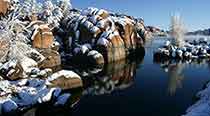
Prescott, Arizona is located in the mountains of north-central Arizona, about 100 miles north of Phoenix. Most visitors arrive by car, with major routes connecting Prescott to Phoenix, Flagstaff, Sedona, the Verde Valley and other destinations throughout Northern Arizona.
If you're driving to Prescott for the first time, don't judge the trip by mileage alone. Elevation changes, mountain highways, weather, construction and weekend traffic can affect travel times. Use the routes below to plan the general drive, then check current navigation and road conditions before you leave.
From Phoenix, the primary route is I-17 north to AZ-69 through Cordes Junction and Prescott Valley. From Flagstaff and much of Northern Arizona, travelers can reach Prescott using I-17 and AZ-169/AZ-69 or use AZ-89 through the mountains depending on their starting point, conditions and preferred route.
How Far Is Prescott from Major Arizona Destinations?
Approximate driving distances and times to downtown Prescott include:
- Phoenix: About 100 miles, typically around 2 hours
- Phoenix Sky Harbor Airport: About 100 miles, approximately 2 hours
- Prescott Regional Airport: About 10 miles, approximately 15–20 minutes
- Flagstaff: Roughly 95 miles, approximately 1 hour 45 minutes to 2 hours
- Jerome: About 35 miles, approximately 50–60 minutes
- Cottonwood: About 45 miles, approximately 1 hour
- Sedona: Roughly 65–70 miles, approximately 1 hour 30 minutes
- Grand Canyon South Rim: Roughly 125–130 miles, approximately 2 hours 30 minutes
These are planning estimates rather than guaranteed travel times. Traffic, construction, weather and road conditions can change the drive considerably.
Directions from Phoenix to Prescott
Driving from Phoenix to Prescott is straightforward and is the route used by many visitors arriving from Phoenix Sky Harbor International Airport.
Primary Route from Phoenix
- Take I-17 North from the Phoenix area.
- Continue north toward Cordes Junction.
- Take the exit for AZ-69 toward Prescott.
- Follow AZ-69 through the Prescott Valley area toward Prescott.
- AZ-69 eventually leads into Gurley Street approaching downtown Prescott.
Plan on approximately two hours under normal conditions, although traffic leaving Phoenix, highway construction and holiday travel can increase the drive.
What Is the Drive from Phoenix to Prescott Like?
The drive changes dramatically as you leave the Sonoran Desert and climb into Arizona's higher elevations. You'll transition from desert vegetation around Phoenix to chaparral and eventually the cooler mountain environment surrounding Prescott.
The elevation change is one reason Prescott can be substantially cooler than Phoenix, particularly during summer.
If you're visiting from the Valley for a weekend, traffic can be heavier on Friday afternoons, holiday weekends and during major Prescott events.
Directions from Phoenix Sky Harbor Airport to Prescott
Visitors flying into Phoenix Sky Harbor International Airport (PHX) can reach Prescott by rental car or shuttle.
By car, leave the airport area and connect with I-17 North, then follow I-17 to AZ-69 toward Prescott.
The drive is roughly 100 miles and generally takes about two hours, although Phoenix traffic can significantly affect travel time.
If you don't want to rent a car, scheduled transportation is also available between Phoenix Sky Harbor and Prescott. See our Prescott airport shuttle guide for transportation options.
You can explore much of downtown Prescott on foot, but a vehicle is useful if you plan to visit Watson Lake, Lynx Lake, Goldwater Lake, trailheads, Prescott National Forest or surrounding communities.
Directions from Prescott Regional Airport to Downtown Prescott
Prescott Regional Airport – Ernest A. Love Field (PRC) is located north of central Prescott.
The airport is roughly 10 miles from downtown, with a typical drive of approximately 15 to 20 minutes depending on traffic and your final destination.
From the airport area, AZ-89 provides a direct route toward central Prescott and eventually connects with Gurley Street near downtown.
See our Prescott airport guide for additional airport information.
Directions from Flagstaff to Prescott
Flagstaff and Prescott are relatively close geographically, but the mountains between them mean the drive takes longer than the mileage might suggest.
One common route uses I-17 south from Flagstaff before connecting with AZ-169 and AZ-69 toward Prescott.
Another option involves AZ-89 and can provide a more mountainous drive depending on your starting point and destination.
Allow roughly two hours and check current navigation before departing, especially during winter weather.
Can You Visit Flagstaff and Prescott on the Same Trip?
Absolutely. The cities provide very different experiences despite both being mountain communities.
Prescott offers Whiskey Row, Courthouse Plaza, the Granite Dells and its lakes, while Flagstaff provides a higher-elevation environment near the San Francisco Peaks and serves as another gateway to the Grand Canyon.
Directions from Sedona to Prescott
Sedona is roughly 65 to 70 miles from Prescott, with typical driving times around 1 hour 30 minutes.
One of the most practical routes uses AZ-179 from Sedona to I-17, followed by AZ-169 and AZ-69 toward Prescott.
Another possibility is traveling through Cottonwood and Jerome on AZ-89A. This can turn the drive into a much more scenic Northern Arizona road trip, but the road through Jerome and over Mingus Mountain is winding and slower.
Fast Route or Scenic Route?
- For a more direct drive: Use the I-17/AZ-169/AZ-69 route.
- For scenery and sightseeing: Consider traveling through Cottonwood and Jerome on AZ-89A.
If you have time, the second option can transform transportation into part of the trip rather than simply a way of getting from one city to another.
Directions from Jerome to Prescott
Jerome is approximately 35 miles from Prescott via AZ-89A.
The route crosses Mingus Mountain and offers expansive views across the Verde Valley and surrounding mountains.
It is also a winding mountain highway with significant curves and elevation changes, so allow roughly an hour and take your time.
This is a scenic mountain road rather than a high-speed highway. Drivers uncomfortable with steep grades, curves or mountain driving may prefer an alternate route between Prescott and the Verde Valley.
See our Jerome guide if you're considering adding the historic mining town to your Prescott itinerary.
Directions from Cottonwood to Prescott
Cottonwood is roughly 45 miles from Prescott, with the most scenic direct route traveling through Jerome and over Mingus Mountain on AZ-89A.
Allow approximately an hour or more depending on traffic and mountain-road conditions.
Travelers who prefer to avoid the winding section through Jerome can use an alternate route through the Verde Valley, I-17, AZ-169 and AZ-69. It is longer in mileage but may be more comfortable for some drivers.
Explore our Cottonwood guide and Verde Valley guide if you're planning a day trip from Prescott.
Directions from Prescott to the Grand Canyon South Rim
The South Rim of Grand Canyon National Park is roughly 125 to 130 miles from Prescott and can be reached in approximately 2 hours 30 minutes under favorable conditions.
A common route travels north from Prescott toward Williams before continuing north on AZ-64 to the South Rim entrance.
Because the South Rim can be visited as a long day trip from Prescott, some travelers leave early in the morning, spend most of the day at the canyon and return in the evening.
However, an overnight stay near the Grand Canyon provides considerably more time for viewpoints, trails and sunset or sunrise.
If you're driving from Prescott to the Grand Canyon and back in one day, leave early. You'll spend roughly five hours in the vehicle before accounting for entrance traffic, stops and driving inside the park.
Prescott to the Grand Canyon North Rim
The North Rim is much farther from Prescott than the South Rim because drivers must travel around the canyon rather than across it.
The drive is roughly 300 miles and typically takes close to six hours each way.
More importantly, AZ-67 to the North Rim is seasonal. Winter conditions close highway access for part of the year.
The North Rim should therefore be treated as an overnight or multi-day trip from Prescott rather than a practical day trip.
Prescott to Grand Canyon West
Grand Canyon West, home of the Skywalk, is a completely different destination from Grand Canyon National Park's South Rim.
It is substantially farther from Prescott than the South Rim, so make sure your navigation is routing you to the correct part of the canyon before leaving.
If your goal is the classic Grand Canyon National Park experience, viewpoints such as Mather Point and access to Grand Canyon Village, you want the South Rim, not Grand Canyon West.
Driving to Prescott in Winter
Prescott sits at an elevation of roughly 5,300 feet and experiences real winter weather.
Snow and ice can affect highways into Prescott as well as mountain routes such as AZ-89A over Mingus Mountain.
If you're traveling during or immediately after a winter storm:
- Check current Arizona highway conditions before departing.
- Allow additional travel time.
- Do not rely solely on the weather at your starting point.
- Be prepared for temperatures to drop as elevation increases.
- Consider postponing mountain-road travel during severe conditions.
Check our Prescott weather guide when planning a winter visit.
Driving to Prescott During Summer Monsoon Season
Arizona's summer monsoon can produce heavy rain, lightning, strong winds and localized flooding.
Storms often develop during the afternoon, so summer travelers should check the forecast before leaving and avoid driving through flooded roadways.
Conditions can vary significantly across Northern Arizona, particularly when you're traveling between elevations.
Planning a Northern Arizona Road Trip Through Prescott
Prescott works particularly well as part of a larger Arizona road trip because several major destinations are within a few hours.
A road-trip itinerary could include:
- Phoenix ? Prescott: Transition from the Sonoran Desert into Arizona's mountain country.
- Prescott ? Jerome: Cross Mingus Mountain to one of Arizona's best-known historic mining towns.
- Jerome ? Cottonwood: Continue into the Verde Valley for restaurants, wine tasting and Old Town Cottonwood.
- Cottonwood ? Sedona: Continue north toward Sedona's red-rock country.
- Sedona ? Flagstaff: Climb into the ponderosa pine forests of the Colorado Plateau.
- Flagstaff ? Grand Canyon: Finish at the South Rim of Grand Canyon National Park.
Prescott can also work as the beginning or end of this loop depending on where you're flying into Arizona.
Arriving in Downtown Prescott
If Prescott is your destination, downtown and the Yavapai County Courthouse Plaza provide a useful central reference point.
Courthouse Plaza sits beside historic Whiskey Row and within walking distance of restaurants, shops, museums and many central Prescott attractions.
Once you've arrived, use our things to do in Prescott guide to plan your visit or compare Prescott hotels if you haven't chosen where to stay.
Distances and driving times are approximate. Construction, accidents, seasonal closures, snow, monsoon storms and traffic can change routes and travel times. Use current GPS navigation and check Arizona road conditions shortly before departure.
Where to Go Once You Reach Prescott
After arriving, these guides can help you get oriented quickly:
- Courthouse Plaza: Start in Prescott's historic center.
- Weekend in Prescott: Follow a two-day itinerary for first-time visitors.
- Granite Dells: Explore Watson Lake, Willow Lake and Prescott's signature granite terrain.
- Where to stay: Compare Prescott lodging options.
- Things to do: Browse Prescott attractions and activities.
Directions to Prescott FAQ
How far is Prescott from Phoenix?
Prescott is approximately 100 miles from Phoenix. The drive typically takes around two hours using I-17 and AZ-69, although Phoenix traffic and road conditions can increase travel time.
How far is Prescott from Phoenix Sky Harbor Airport?
Phoenix Sky Harbor International Airport is approximately 100 miles from Prescott. Most travelers should allow about two hours for the drive, plus additional time when Phoenix traffic is heavy.
How far is Prescott from Sedona?
Sedona is roughly 65 to 70 miles from Prescott. The drive generally takes around 1 hour 30 minutes depending on the route and traffic.
How far is Prescott from Flagstaff?
Flagstaff is roughly 95 miles from Prescott, with typical driving times around 1 hour 45 minutes to 2 hours depending on route and conditions.
How far is Prescott from Jerome?
Jerome is approximately 35 miles from Prescott via AZ-89A. The drive usually takes around an hour because the route crosses winding mountain terrain.
How far is Prescott from the Grand Canyon?
The Grand Canyon South Rim is roughly 125 to 130 miles from Prescott and typically takes about 2 hours 30 minutes to reach. The North Rim and Grand Canyon West are considerably farther away.
What is the best route from Phoenix to Prescott?
The most common route is I-17 North from Phoenix to AZ-69 at Cordes Junction, then AZ-69 through Prescott Valley into Prescott.
Do you need a car when visiting Prescott?
Downtown Prescott is walkable, but a car is useful for reaching Watson Lake, Lynx Lake, Goldwater Lake, Prescott National Forest, trailheads and nearby destinations such as Jerome and the Verde Valley.
Does it snow on the drive to Prescott?
Yes. Prescott and the surrounding higher-elevation highways can receive snow and ice during winter. Travelers should check weather and current highway conditions before driving during winter storms.